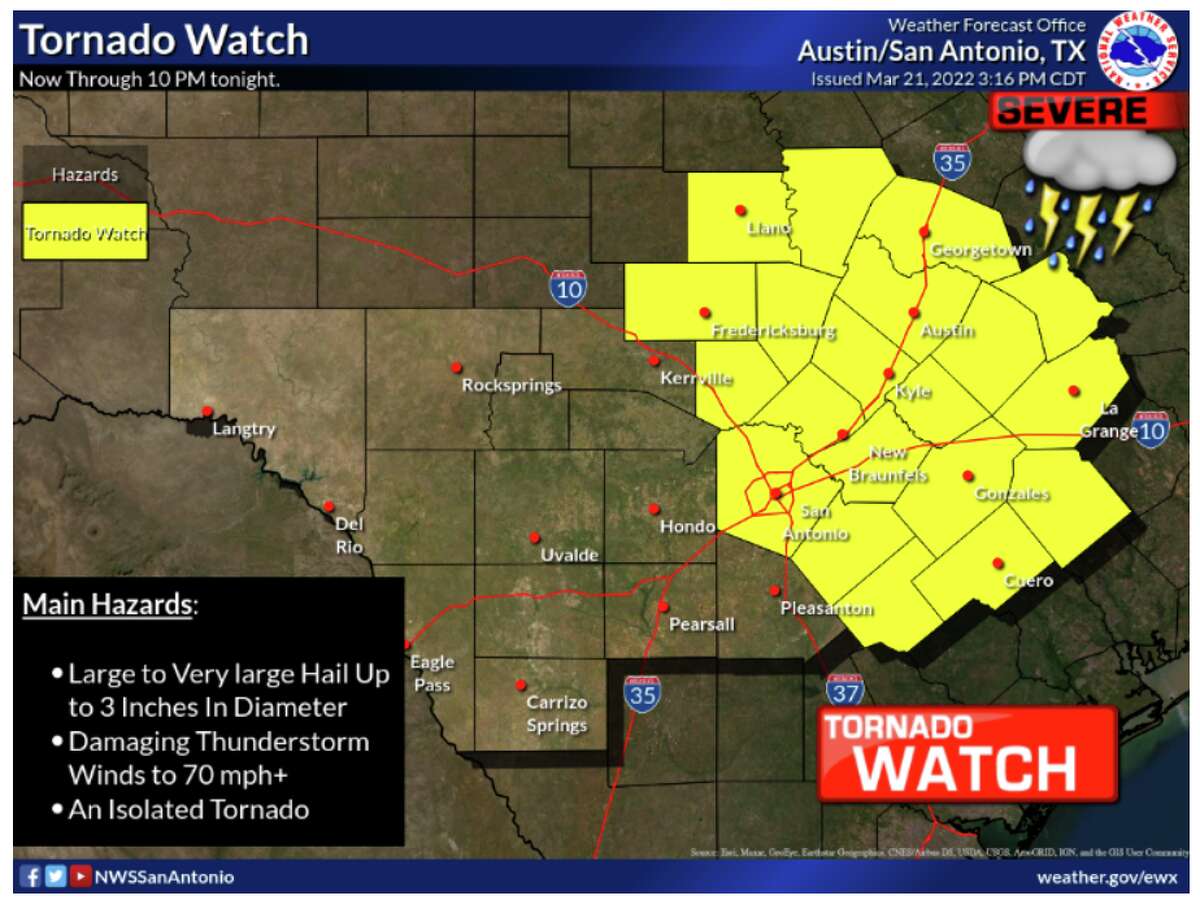
Travis County, Texas: Tornado Watch for the several counties has been issued by The National Weather Services on Monday, March 21.
The Tornado Watch has been issued by National Weather Serviece untill 10 p.m.
The list of the counties mentioned by the National weather service for Tornado watch are given below: Gillespie County, Hays County, Bastrop County, Caldwell County, Lee County, Blanco County, Travis County, Llano County, Burnet County, Williamson County, Fayette County, Bell County, Milam County and Lampasas County.
Potentially a very dangerous situation developing this afternoon and evening.
Wind, Hail and Tornadoes all possible.
Please prepare your plan NOW. pic.twitter.com/ZCRevikA2a— Scott Fisher (@ScottFisherFOX7) March 21, 2022
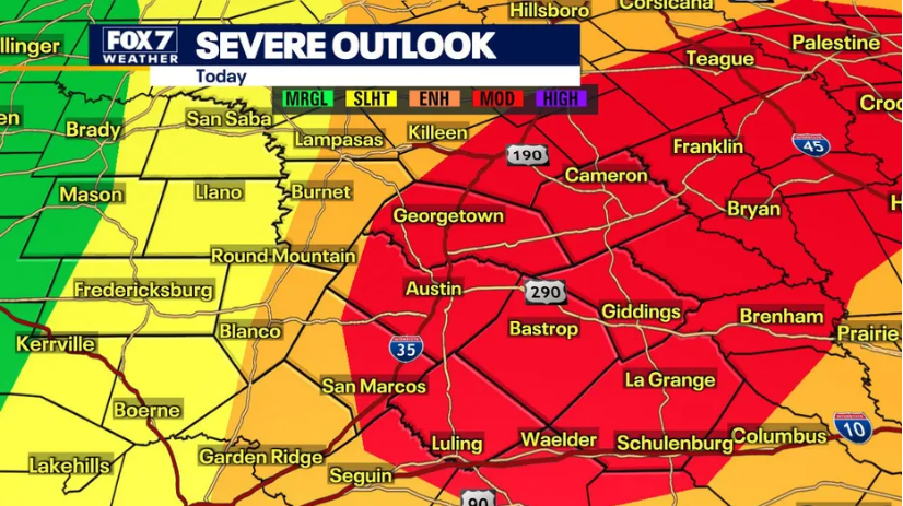
For Monday March 21 most of the areas of Texas counties has been updgraded from enhanced for moderate risk of Weather. The Upgrade has been issued due to risk of Tornado and hail potential. This also has been said that strong tornadoes and possibility of golf ball and baseball size hail late this afternoon and evening.
As per the forecast expert Carlo Falco from Fox 7 Austin storm threat modes will begin as hail, and there is possibility of transition of large hail to very large before turns into tornado threat.
Carlo Falco also said that Storms should fire along a dry line in the TX Hill Country near Hwy-281, moving east with tornado & hail threat approaching I-35 by 4-7 p.m.
It was also said that trajectory of storm will move east with the possibility of increase in intensity across eastern counties and along coastl plain. Also they could depart the Austin area by 9-11 p.m.